Technical Information
Quiet and unobtrusive
Our electric UAVs are barely audible to an observer on the ground when operating at standard height. This mimimal environmental footprint makes them ideal for operations where wildlife is present.
Products
Orthophotos (geo-referenced)
Digital Surface Models (geo-referenced)
Full-colour Point Clouds (geo-referenced)
Infrared & colour-coded Vegetation Index imagery
Google Earth KMZ Orthophotos
3-D Animations (fly-through)
Online 3-D Models (spin around with mouse)
Comprehensive Metadata
Technologies
Low-level UAVs for high resolution imagery
Visible and near-infrared cameras used on UAVs
RTK GPS equipment for georeferencing
Software for Orthophotos, Digital Surface Models, Point Clouds etc
Specifications
Spatial Resolution: 3cm/pixel (typical)
Model accuracy: 5cm (typical)
Coverage per 3 flights: 100 ha (using fixed wing UAV)
UAV operating altitude: 300’ typical, 400’ maximum
Image formats (2D): GeoTIFF, ECW, JPG, KMZ (Google Earth)
Point Cloud formats (3D): LAS, XYZ with normals
Digital Surface Models (3D): GeoTIFF, XYZ grid
Textured Models (3D): FBX, 3DS & more
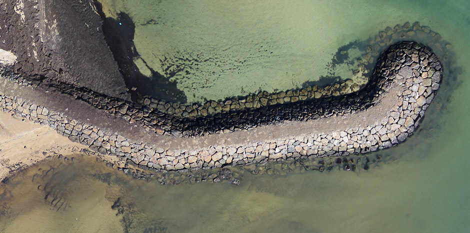
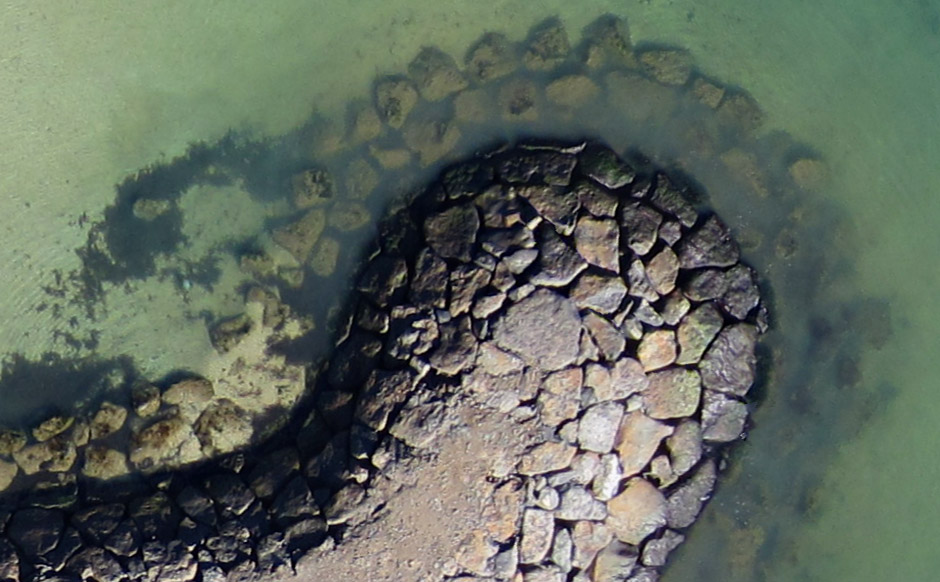
Ultra-high Resolution
The images below are from a 280 Megapixel orthophoto covering approximately one kilometre of coastline, from a demonstation survey in 2014. The zoomed-in lower image shows the level of detail achieved with 3 centimetres per pixel. It is quite remarkable when one considers that this level of detail exists across the entire surveyed area.
Because the imagery is geo-referenced, coordinates of objects can be displayed, and distances measured. Many software packages allow this. Typically we also provide a 3-dimensional Digital Surface Model and full-colour Point Cloud. These products are also geo-referenced, and we can help you select software for viewing and measuring the data.
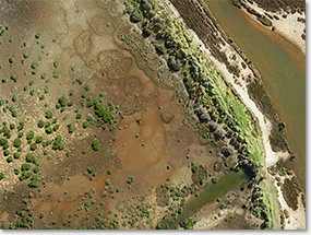
Natural Resource Management
Monitor vegetation
Georeferenced imagery supplied by UAVs is ideal for resource management. Rapid deployment and lower costs allow more frequent flights to monitor changes in vegetation. High resolution allows easy identification of invasive pest species such as Spartina in wetlands. In certain applications, we capture multispectral imagery for identifying weeds. See FAQ.
Post-Burn Assessments
After fuel reduction burns, assessments are greatly assisted by high-resolution, georeferenced imagery provided by our UAVs. After bushfires, when urgent assessments are needed, conventional aerial surveys are sometimes hampered by low-level cloud. Our UAVs avoid this problem because they operate beneath cloud, at altitudes of 400 feet and below.
Precision Agriculture
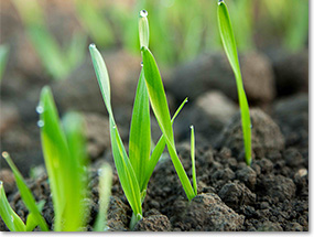
Plantation and Crop Health
Spotting problem areas early is critical. We supply multispectral and colour-coded Vegetation Index imagery to identify weeds in fallow fields, and areas in crops where growth is stunted. Big savings can be made by fertilising only the areas that need it. The resolution is dramatically better than from a satellite – 3 centimetres per pixel compared to several metres.
Drainage and Floods
Topographical information about a parcel of land is very useful for assessing drainage and flood issues. We can supply this information as contour maps (hard copy or digital), and as 3-D terrain models, often called DSMs (Digital Surface Models).
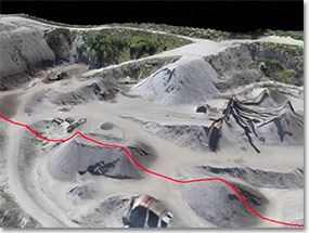
Mining and Earthworks
Mine Extraction Volumes, Stockpile Volumes
Once a 3D terrain model has been generated, it is a simple matter to perform volume calculations. We can do this for the client, or alternatively the client may wish to perform their own analysis with the data that we provide.
Slope measurements
For earthworks, slope measurements are often required. Slope can be measured across any part of the 3D terrain model, in any direction.